
Fairfield-Vacaville, CA (FFV)
Located between Fairfield, Vacaville and Travis Air Force Base, the station is envisioned as the anchor for a future mixed-use community to include housing, offices, recreational areas and commercial spaces within easy walking distance of rail service.
4921 Vanden Road
Fairfield, CA 94533
Annual Station Ridership (FY 2023): 51,360
- Facility Ownership: City of Fairfield
- Parking Lot Ownership: City of Fairfield
- Platform Ownership: City of Fairfield
- Track Ownership: Union Pacific Railroad
Alex Khalfin
Regional Contact
governmentaffairsoak@amtrak.com
For information about Amtrak fares and schedules, please visit Amtrak.com or call 1-800-USA-RAIL (1-800-872-7245).
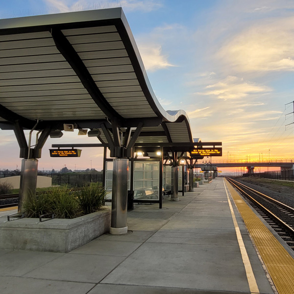
The new Fairfield-Vacaville station opened on Nov. 13, 2017, becoming the eighteenth stop along the Capitol Corridor route. The facility, which consists of platforms with canopies, and a broad pedestrian and cyclist passageway underneath the tracks, is located about five miles east of the Suisun-Fairfield station. Ample parking for cars and bikes is available.
Located northeast of Fairfield, south of Vacaville and north of Travis Air Force Base, the station, conceived of in the late 1990s, is envisioned as the anchor for a future mixed-use community to include housing, offices, recreational areas and commercial spaces within easy walking distance of rail service. Much of the immediate area is currently dedicated to agriculture, grazing and industrial uses.
Construction of the station was just one element of a larger $78 million project comprised of a new road overpass across the tracks, a bus passenger plaza and trackwork to accommodate a center platform. Project partners included the cities of Fairfield and Vacaville, the Solano Transportation Authority, Metropolitan Transportation Commission, Capitol Corridor Joint Powers Authority, California Department of Transportation, the Federal Transit Administration and Union Pacific Railroad.
In September 2019, the station was renamed in honor of Thomas M. Hannigan, who as a state assemblyman pushed for improved rail service in California and was instrumental in the creation of the Capitol Corridor service. In addition to his time in the California State Assembly, Hannigan had earlier served on the Fairfield City Council and the Solano County Board of Supervisors.
Prior to the discovery of gold at Sutter’s Mill in 1848, much of present-day California was lightly settled by Europeans—mostly Spaniards—who were gathered in coastal cities that had been established around Catholic missions or fortifications. The first explorers who made forays into the area around Fairfield and Vacaville in the 18th century encountered bands of Patwin American Indians. Known as the “Suisunes”—meaning “People of the West Wind”—their name highlights the famous summer winds that sweep across the landscape.
During the late 18th and early 19th centuries, the Spanish in the region had numerous encounters with the Suisunes, who offered shelter to American Indians who had run away from the Spanish missions. By the late 1810s, several groups of Suisunes were forced to live at missions Dolores and San Jose, located in San Francisco and Fremont, respectively. Others moved to Mission San Francisco Solano when it was established at Sonoma in 1823. An “asistencia,” or ranch and farm meant to support the main mission, was founded by the Sonoma group to the west of current day Fairfield.
In the years following Mexico’s independence from Spain in 1821, most of the mission properties were secularized and broken-up into “ranchos,” or ranches, that were subsequently granted to the friends and family members of important Mexican officials. The lands belonging to Mission San Francisco Solano were placed under the control of General Mariano Vallejo, who was known for putting down American Indian revolts. In 1838, Vallejo provisionally granted approximately 18,000 acres to Francisco Solano, a Suisun who had been raised at the mission and who had assisted Vallejo in his campaign against the tribes. Known as the Rancho Suisun, the land grant encompassed most of present-day Fairfield.
Southwest of Vacaville, the Laguna and Vaca valleys were settled by Juan Manuel Vaca and Juan Felipe Peña, who had arrived from New Mexico with their families in 1841. They raised cattle on the grasslands for hides and tallow that could be traded for various goods. To the north, along Putah Creek, John Wolfskill, the first American to settle in what is now Solano County, began to raise cattle and established a farm. Wolkskill became known for the variety of fruits and nuts grown in his orchards, which included black walnuts, pecans, pomegranates, apricots, figs and olives.
The 44,384-acre Mexican land grant given to Vaca and Peña in 1845 was known as Rancho Los Putos, while Wolkskill’s 17,754-acre tract was called Rancho Rio de los Putos. Both were derived from a corruption of “Putah”— taken from “puta wuwwe,” which in the Miwok language used by the Patwin meant “grassy creek.”
Today visitors are granted a view into the life of early settlers at the Peña family adobe. Constructed in 1842, it stands as the oldest built structure in Solano County. Originally consisting of a main room and two bedrooms, it had two-foot thick walls of locally-made adobe blocks, redwood timbers from the Napa area and a tule-thatched roof. Four decades later, the home was enlarged and the walls encased in wood sheathing. The Peña Adobe remained in the family until 1957, and following extensive restoration, became the centerpiece of a Vacaville city park. Now run by a non-profit historical society, the home is open for tours and is subject to ongoing restoration work.
California remained under Mexican control until it was ceded to the United States by the Treaty of Guadalupe Hidalgo that ended the Mexican-American War of 1846-1848. The original Mexican land grants were honored by law, but confirming them in American courts was a long and expensive process. The Vacas and Peñas paid for the legal fees and taxes largely in land; by 1880, the families had lost most of their original grant.
Just as the war came to a close, gold fever overtook California. Speculation in land and other goods drove up prices, but the prospectors were a captive audience. In 1850, Archibald Richie, a San Francisco-based merchant, decided to purchase the Rancho Suisun. He quickly subdivided the property and sold a one-third interest to Captain Robert Henry Waterman, who had been one of the great clipper ship captains of the time. Prior to the completion of the transcontinental railroad in 1869, clipper ships, setting a course via the Strait of Magellan, were the fastest means of traveling between the east and west coasts of the United States.
Recognizing the need to feed hundreds of thousands of newly arrived gold seekers, Waterman decided to establish a wharf at a point close to the road between Benicia and Sacramento. Agricultural products from Solano County could then be shipped out to growing cities via the region’s numerous bays, rivers and sloughs. Waterman chose a spot that he called Bridgeport but later renamed “Cordelia” in honor of his wife. While adequate for shipping, Waterman’s venture was soon eclipsed by that of Josiah Wing, another former sea captain who had staked his future on the wealth of the land.
In 1852, Wing purchased what he thought was an island, as well as 600 acres, just beyond Waterman’s property. Located at the navigable head of Suisun Slough, a wide and deep stream that cut through a large tule marsh, the island seemed an excellent site for establishing a wharf and warehouse for the storage of agricultural goods. Upon further investigation, the island turned out not to be one after all—at low tide, a spit of land connected it to the mainland.
Closer to local farming centers and easier to reach by boat, the new community—later known as Suisun City—flourished as a trading depot and quickly took away business from Cordelia. Wing experienced great success by transporting shiploads of grain. Not to be outdone, Waterman laid out a town on the mainland north of Suisun City in 1856. Named after his hometown of Fairfield, Conn., its growth was secured when two years later it was made the seat of rapidly growing Solano County.
Meanwhile, in 1850 Vaca had sold about nine square miles of land to William McDaniel for $3,000. He ensured his place in history by requiring one square mile to be reserved for a town to be called “Vacaville.” Vaca controlled about half of the town’s lots, and Peña later received a share. The town was formally established in Dec. 1851.
Over the years, Fairfield and Vacaville grew in tandem; Fairfield was home to government institutions while Vacaville became the center of an important fruit- and nut-growing region. Prior to the American Civil War, early landowners built a road connecting the Vaca, Pleasant and Laguna valleys to the bustling wharf at Suisun City so they could get their fruit to a broader market. Today this path is traced by Pleasants Valley Road just west of Vacaville.
Growth of the agricultural sector was boosted by the arrival of the railroad in 1868. The original plan for the western portion of the first transcontinental railroad called for the Western Pacific Railroad (WP) to build the 140-mile section between Oakland and Sacramento, where it would meet the Central Pacific Railroad (CP). In 1865, the California Pacific Railroad (Cal-P) was incorporated with the purpose of constructing a competing line from Sacramento to Vallejo.
Located where the western end of the Carquinez Strait meets San Pablo Bay, Vallejo became a transfer point where passengers and goods could be moved from railcars to a ferry in order to continue on to San Francisco. The proposed route was only 90 miles and therefore quicker and more convenient than the WP. Subsequently, the WP’s allies at the CP attempted to stop the Cal-P from making its way into Sacramento. Ultimately unsuccessful in its efforts, the CP bought out the upstart a few years later.
Unlike Fairfield, Vacaville was located a few miles off the CP and thus had no direct rail connection. But this problem was solved in 1869 when the Vaca Valley Railroad completed a short line from Elmira, located on the CP, west to Vacaville. Present-day Elmira Rd. follows the path of the old railroad, and a wooden depot was located in downtown Vacaville near the crossing with Depot Rd. By 1875, the Vaca Valley Railroad was extended north to Winters, and reached Rumsey in 1888. At that point, it was subsumed into the Northern Railway, which was controlled by the larger Southern Pacific Railway (the SP leased the CP in 1885). The latter continued passenger service on the line until 1934.
In 1879, the CP finished construction of a new route from Suisun City to Benicia, located on the eastern end of the Carquinez Strait. At Benicia, entire trains were broken up and loaded unto the Solano, a railroad ferryboat. Built in 1879 for the start of service across the strait, it was touted as the largest ship of its kind in the world. Although the process of loading the rail cars onto the ship sounds complicated and cumbersome, the railroad and ship crews ran a coordinated and streamlined operation. Within 30 minutes, they were able to break up the cars and load them on deck, sail across the waterway, and reassemble the train. The Solano and its sister ferry the Contra Costa were in operation until the SP completed a bridge across the Carquinez Strait in 1930.
With the advent of refrigerated cars—referred to as “reefers” in railroad lingo—it became possible to ship large portions of the region’s harvest as far away as the East Coast. California soon gained a reputation as America’s garden. In addition to grains and hay, the land sprouted orchards of Bartlett pears, plums, peaches, apricots, and exotic items such as pomegranates and persimmons. Almonds, figs and olives were also grown. Of all these products, the Vacaville area became especially known for cherries.
As the fruit and nut industries grew, so did Vacaville. By the 1880s, the town of about 350 residents could claim three general stores, a hotel, bank, lumber yard, two blacksmiths and wagonmakers, and numerous other businesses. During the harvest season, which lasted for almost two-thirds of the year, residents found employment in fruit packing houses and canneries. In 1881, local farmers shipped more than 9.8 million pounds of fruit and vegetables, while a cannery produced 336,600 cans of apricots, pears and other fruits.
Immigrants from China, some who had originally come to the United States to work on the transcontinental railroad, settled in Vacaville to labor in the orchards. A small Chinatown formed along Dobbins Street. By the beginning of the 20th century, they were joined by Japanese immigrants who also leased and ran orchards, becoming vital to the region’s agricultural success. They too established a tight-knit business community along Dobbins Street, founded places of worship and started sports teams for baseball, basketball and sumo wrestling.
For the Japanese-Americans, life abruptly changed after the bombing of Pearl Harbor by the Empire of Japan in December 1941 – bringing the United States into World War II. The American government reacted by ordering the forced relocation of Japanese Americans away from the coast, due to unwarranted fears that some might collaborate with the Japanese enemy. In early May 1942, Solano County’s nearly 1,000 Japanese-American residents were put on buses and trains and sent about 100 miles southeast to the community of Turlock, located in the San Joaquin Valley.
The war also led to the establishment of the Fairfield-Suisun Army Air Base in 1943 east of Fairfield and south of Vacaville. The site was chosen because it was flat, inexpensive and was near good rail and water transportation. One of a number of bases intended to protect the West Coast from attack, it initially consisted of about 1,000 acres with two runways and a few temporary structures.
As the war in the Pacific ramped up, Fairfield became a major supply transfer point. Drawing the outline of an aircraft carrier on the ground, pilots practiced their landings and takeoffs; the region’s famous west-blowing winds were considered an ideal approximation of those encountered at sea. By the 1960s, the installation, now known as Travis Air Force Base (AFB), covered more than 6,000 acres. In the 21st century, Travis has gained a reputation as the “Gateway to the Pacific,” and is noted for handling more cargo and passenger traffic than any other military air terminal in the country. It accommodates approximately 7,300 active Air Force personnel, 4,250 Air Force Reserve personnel and 3,770 civilians.
In the latter half of the 20th century, Vacaville and Fairfield expanded quickly, becoming sought-after communities within the busy corridor between the state capital and the San Francisco Bay area. Travis AFB remains a significant regional employer, but Vacaville is also known for its life-science companies and premium shopping outlets, while Fairfield hosts the county government and major medical services.
Vacaville is famous throughout central California for its annual Fiesta Days, a celebration of Western rodeo and Hispanic heritage that includes a parade, beauty pageant, live music, food vendors and other entertainments. Held in the late spring, Fiesta Days goes back to 1957.
The Capitol Corridor route is primarily financed and operated in partnership with the State of California. It is managed by the Capitol Corridor Joint Powers Authority (CCJPA), which partners with Amtrak, the Union Pacific Railroad, Caltrans and the communities comprising the CCJPA to continue development of a cost-effective, viable and safe intercity passenger rail service.
Station Building (with waiting room)
Features
- ATM not available
- No elevator
- No payphones
- No Quik-Trak kiosks
- No Restrooms
- Unaccompanied child travel not allowed
- No vending machines
- No WiFi
- Arrive at least 30 minutes prior to departure
Baggage
- Amtrak Express shipping not available
- No checked baggage service
- No checked baggage storage
- Bike boxes not available
- No baggage carts
- Ski bags not available
- No bag storage
- Shipping boxes not available
- No baggage assistance
Parking
Accessibility
- No payphones
- Accessible platform
- Accessible restrooms
- No accessible ticket office
- No accessible waiting room
- Accessible water fountain
- No high platform
- No wheelchair
- No wheelchair lift
Hours